
Topographical Normalization of Remotely Sensed Imagery
This animation generated by the Centre for Geographical Analysis (CGA) at Stellenbosch University illustrates the importance of topographical normalization when working with satellite images.
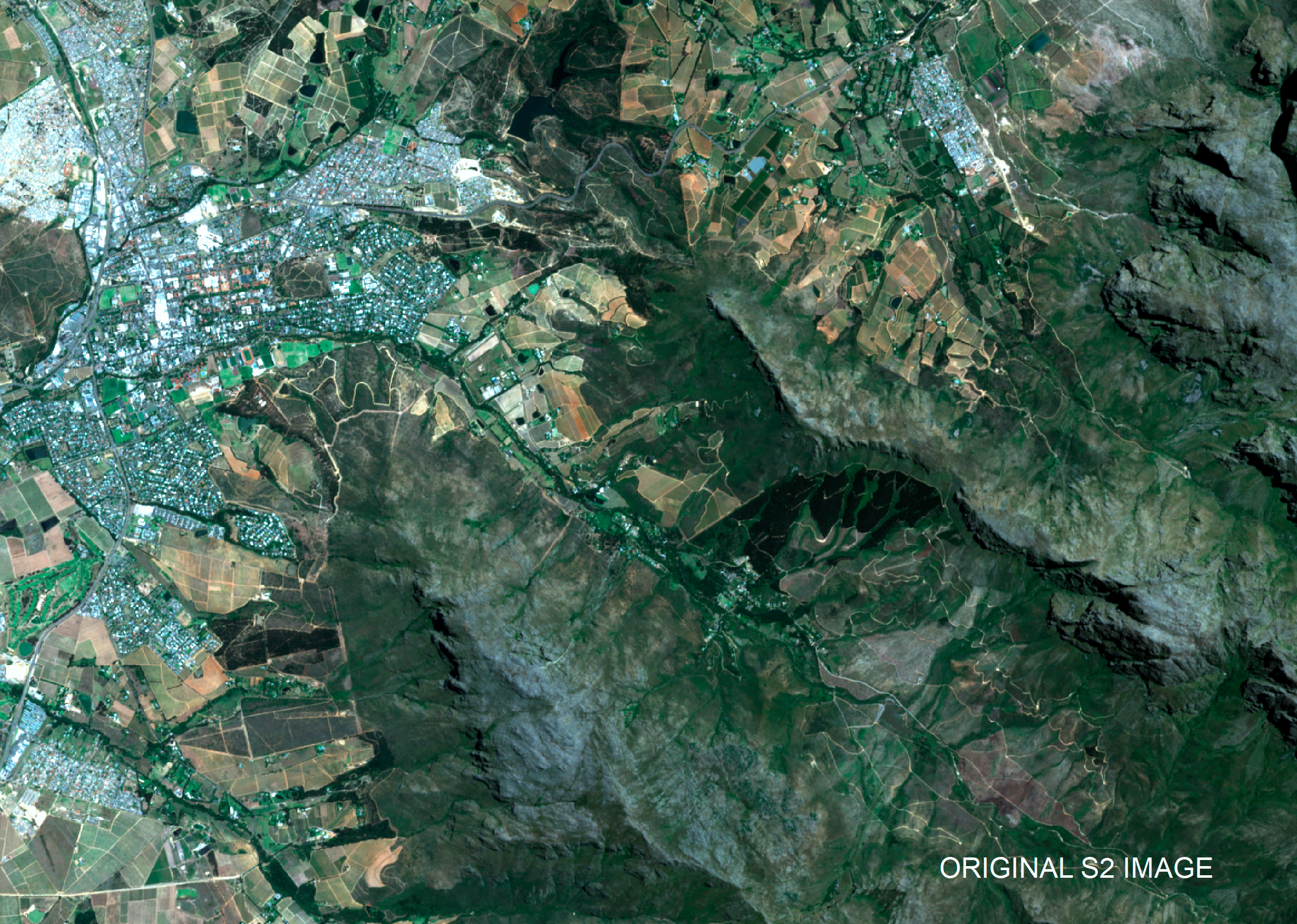
In this example, a Sentinel-2 image of Stellenbosch was normalized using the Digital Elevation Model of South Africa @ 2m resolution (DEMSA2) and PCI Geomatica software. Geomatica does an excellent job to reduce contrasts and variations between southern and northern slopes. This is critical for when satellite images are intended for quantitative methods. For instance, much simpler land cover mapping rule-based are needed because there is no need to accommodate (have separate rules for) shadowed areas. Topographical normalization effectively reduces within-class variations, which improves machine learning classification accuracies and reduces the need for large quantities of training samples.
However, the quality (resolution and accuracy) of the digital elevation model (DEM) that is used as input to the topographical normalization is critical. Based on our experiments, a DEM with a resolution of 10m or higher is required for Sentinel-2 imagery. Also, a digital surface model (DSM) is more effective than a digital terrain model (DTM) as illumination variations caused by large surface features (e.g. buildings) can also be corrected.