
Description
Contours are essential for many applications, including construction planning, hydrological modelling and environmental management. Geosmart Space provides contour data with 50 cm vertical interval spacing for anywhere in South Africa. Other intervals (e.g. 1 m, 2 m, 5 m) can also be provided. The contours can be converted to various formats, including those compatible with engineering software such as CAD.

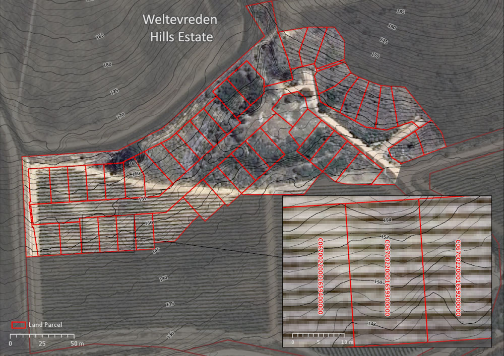
The image on the right shows an example of contours for a construction site. The high-resolution aerial photography (or satellite imagery) shown in the background can also be provided.
Product Specification
| Vertical interval | 50 cm, 1 m, 2 m, 3 m, 5 m |
| Vertical accuracy | 50 cm |
| Horizontal accuracy | 1 m |
| Format | Shapefile (shp), CAD (dwg or dxf), text (xyz, csv, ASCII), and geopackage (gpkg) |
| Price | See pricelist below |
The contours are derived from our DEMSA2 products. Depending on the product ordered, this can be either from a digital terrain model (DTM) or a digital surface model (DSM). In other words, the contours can either represent only the bare earth elevation, or include the heights of objects (e.g. trees, buildings) on the earth’s surface as well. See the conceptual difference between a DTM and a DSM in this image:
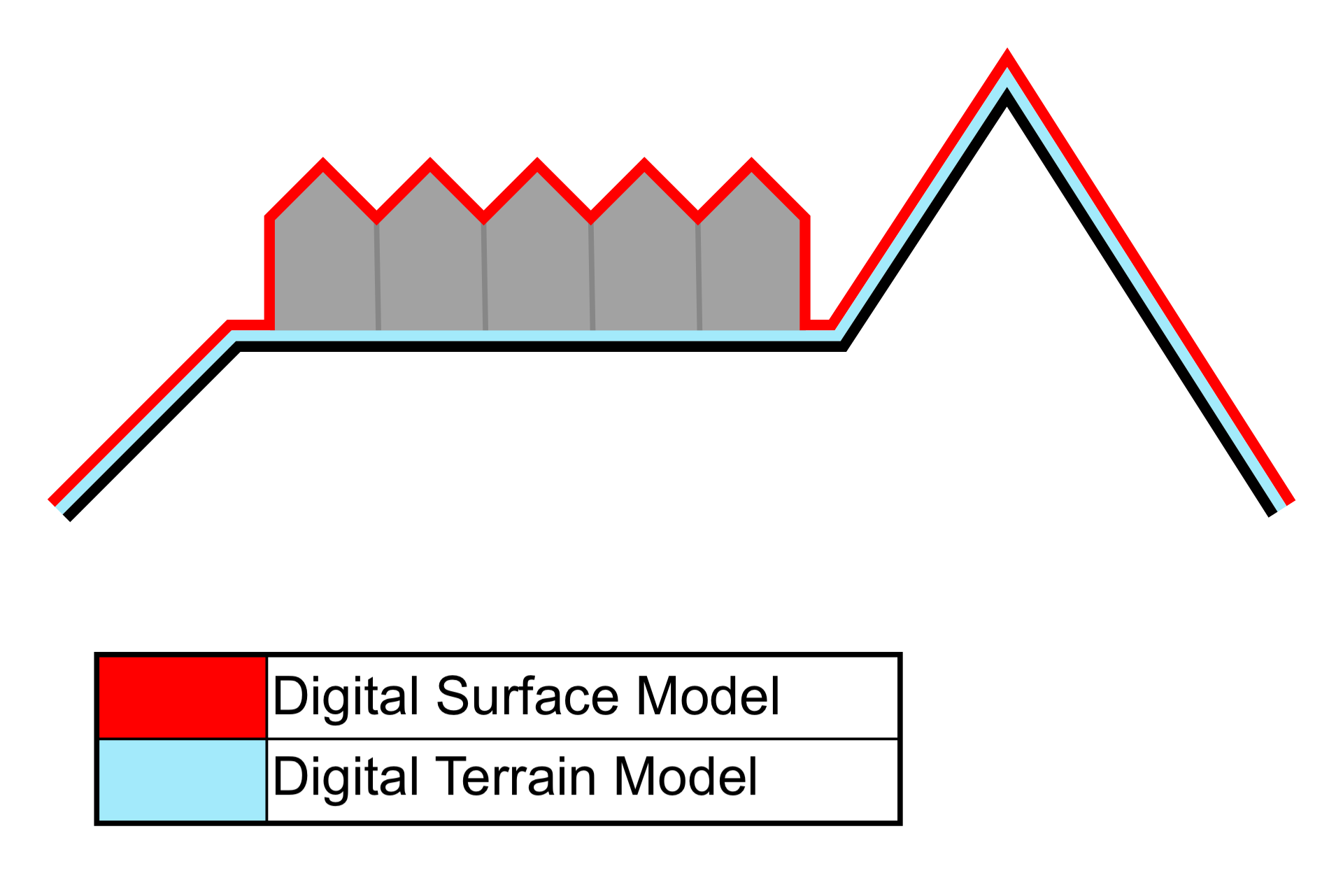
Using a process called DSM2DTM conversion, we infer the heights of the bare earth by removing surface objects from the DSM. We call the resulting DTM the DEMSA2 L3 product. However, it should be noted that DSM2DTM conversion is never perfect, and we cannot guarantee quality conversions. In some areas (e.g. forested landscapes), it is impossible to infer the bare earth terrain (because it is not visible), which can cause gross errors and artefacts.
Pricing
| Derived from | Small area (< 400 km²) | Medium area (400 - 9 999 km²) | Large (> 10 000 km²) | Turnover time* |
|---|---|---|---|---|
| DEMSA2 L1 (Raw DSM) | R3 450 per AOI + R50 per km² | R34 per km² + R550 per AOI | R28 per km² + R550 per AOI | TBD |
| DEMSA2 L2 (Quality Controlled DSM) | R6 050 per AOI + R85 per km² | R63 per km² + R550 per AOI | R57 per km² + R550 per AOI | TBD |
| DEMSA2 L3 (DTM) | R7 150 per AOI + R160 per km² | R126 per km² + R550 per AOI | R86 per km² + R550 per AOI | TBD |
*Turnover time will be lower for less complex terrain types. Please enquire for a more accurate timeframe.
*Areas of interest must be rectangular, with a minimum width of 1 km.
*Substantial discounts (up to 50%) are offered on large orders. Please enquire.
*Prices are VAT exclusive
*Aerials are freely available to download from the NGI web portal. Our service fee is for sourcing the images
Estimate Cost and Request a Quote
Complete the form and we’ll be in touch as soon as possible.
Step 1: Select Product
Step 2: Specify Area of Interest (AOI)
Step 3: Inspect Price Estimation
Product Cart
| AOI Name | Product | AOI Area | Price per km² | Processing Fee | Total Price (Excl. VAT) | Total Price (Incl. VAT) | Actions |
|---|
Summary
| Subtotal (Excl. VAT): | R 0.00 |
| VAT (15%): | R 0.00 |
| Grand Total (Incl. VAT): | R 0.00 |
For large orders (>5 000 km2), please contact us directly as such orders are often heavily discounted.